Back to Search
Start Over
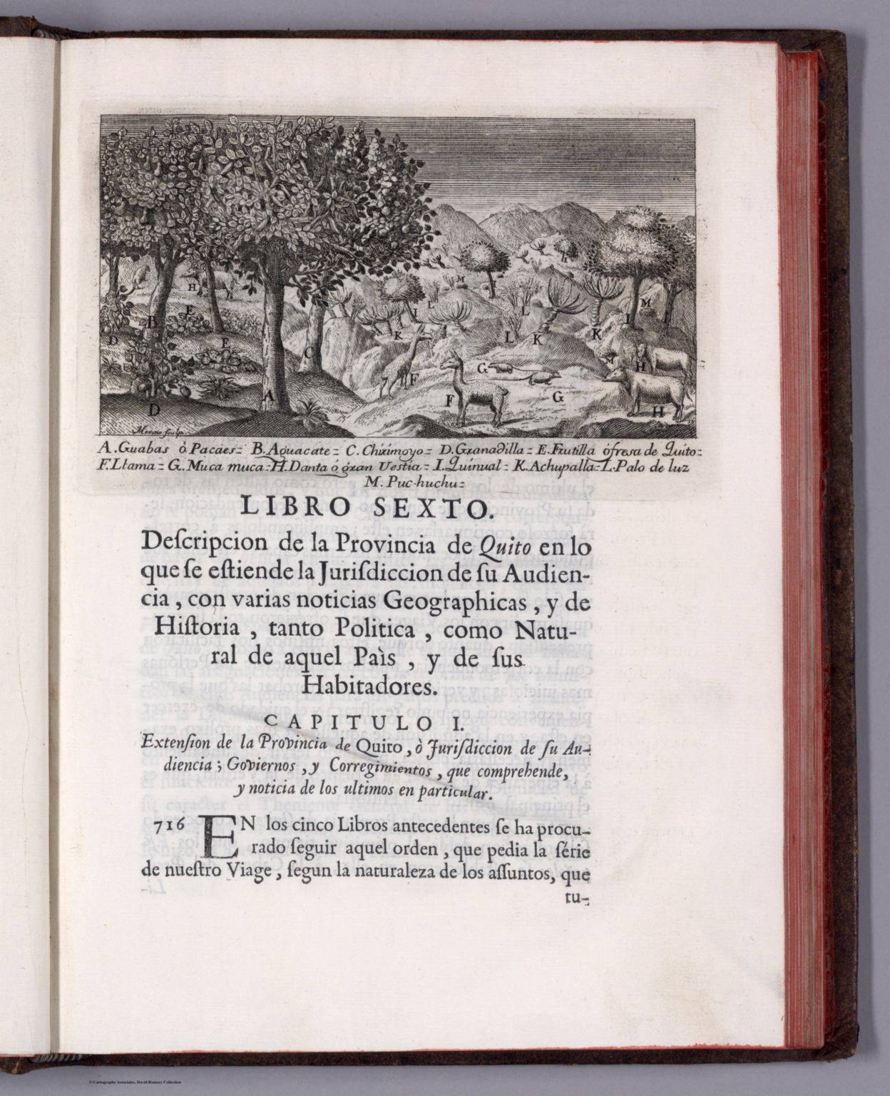
(Text Page to) Libro sexto. Descripcion de la Provincia de Quito en lo que se estiende la Jurisdiccion de su Audiencia, con varias noticias Geographicas, y de Historia, tanto Politica, como Natural de aquel Paìs, y de sus Habitadores.
- Publication Year :
- 1748
- Publisher :
- Antonio Marin, Madrid, 1748.
-
Abstract
- Historical text to the sixth part - in the second volume - of Relacion historica del viage hecho de orden de S. Mag. a la America Meridional. Describes the voyage in the city of Quito. With a pictorial view featuring figures, topography, flora and fauna. View indexed, with key below. Black and white engraving. Text has historiated initial. (Page number inferred.)<br />Relacion historica del viage hecho de orden de S. Mag. a la America Meridional, by Antonio de Ulloa and Jorge Juan; published in Madrid by Antonio Marin, 1748. Title translates (loosely) to: Historical relation of the trip to South America made by order of S. Mag. to measure degrees of the terrestrial meridian, and to come by them in knowledge of the true figure and magnitude of the Earth, with several other astronomical and physical observations. Four volumes, bound in leather. Spines have raised bands and gilt floral ornamentation, as well as leather labels with gilt titles. Each volume has marbled end papers with the same bookplate on verso of front cover. Collation: V. I: [1-24], [1], 2-404 pages, 1-5, VI-XIII leaves of plates; V. II: 4, 405-682 pages, XIV-XXI leaves of plates; V. III: [1-12], [1], 2-379, pages, I-X leaves of plates; V. IV: [1-4], [381], 382-603, i-cxcv pages, XI-XII, [XIII] leaves of plates. Each volume includes a half title page and title page with an engraved illustration. Prologue in first volume; table of contents and errata in first and third volumes; indexes in second and fourth volumes; frontispiece in third volume; text throughout. Together, the four volumes contain 12 maps, as well as numerous profile views, illustrations and portraits. Maps show cities, fortifications, roads, bridges, topography, vegetation, bodies of water, drainage, coastlines, islands, shoals, depths, ports and anchorage. Some maps formatted as bird's-eye-views. Black and white engravings. Full scan of the work is available at The Internet Archive (see Pub Reference). For French single-volume atlas of Quito in the Collection, see Pub List No. 14377.000.<br />https://archive.org/details/A313202
- Subjects :
- Quito (Ecuador)
Subjects
Details
- Database :
- LUNA Commons
- Publication Type :
- Map
- Accession number :
- edsluc.RUMSEY.8.1.343590.90111491
- Document Type :
- Regional Atlas<br />Exploration Book<br />Text Page<br />View